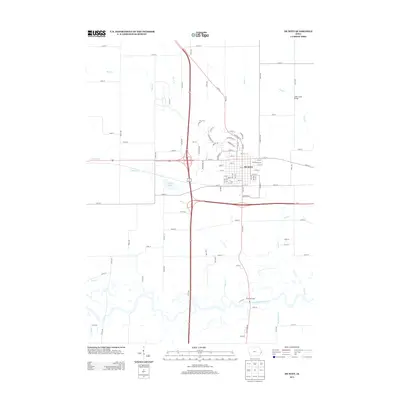
2013 Map of De Witt
USGS Topo · Published 2013About this map
The city of De Witt sits at the center of a dense road and highway network, serving as a primary regional hub in Clinton County. The landscape is defined by the winding course of the Wapsipinicon River to the south, into which several local tributaries drain, including Silver Cr and Ames Cr. This 2013 survey illustrates the modern layout of the city and its surrounding agricultural grid, which is punctuated by recreational and community sites like the 4-H Fairgrounds and Wildwood Camp. Significant local landmarks like the Ames Creek Bridge and Crystal Lake provide clear orientation points for those studying the area's contemporary development. The map details how the various creeks, such as Rock Cr and Crystal Cr, interact with the local county highway system, specifically Co Hwy F21, showing the modern connectivity between rural homesteads and the central municipality.
Find a feature on this map
103 named features on this map. Tap any name to fly to it.
Don’t see what you’re looking for? This feature index may not catch every label — zoom into the map to look around manually.
Map Details
Editions of this 2013 De Witt Map
This is the sole edition of this map. No revisions or reprints were ever made.
Other maps of this area

1891 · DeWitt
USGS Topo · 1:62,500

1891 · Davenport
USGS Topo · 1:62,500

1892 · Goose Lake
USGS Topo · 1:62,500

1892 · Leclaire
USGS Topo · 1:62,500

1893 · Leclaire
USGS Topo · 1:62,500

1894 · Goose Lake
USGS Topo · 1:62,500

1894 · Davenport
USGS Topo · 1:62,500

1899 · Clinton
USGS Topo · 1:125,000

1901 · Rock Island
USGS Topo · 1:125,000

1910 · Rock Island
USGS Topo · 1:125,000