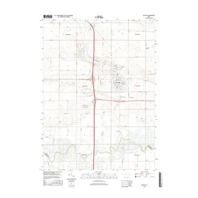
2015 Map of De Witt
USGS Topo · Published 2015About this map
The Wapsipinicon River meanders across the southern landscape of this 2015 survey, defining the natural border between Clinton and Scott counties. The settlement of De Witt serves as the central hub of the region, where a dense grid of residential streets like 10th St and 8th St meets industrial corridors along Industrial St. The area's history is well-preserved in its local burial grounds, including the large Elmwood Cem and Saint Joseph Cem on the northern edge of town, and the more isolated Smith Cem to the southwest.
Find a feature on this map
64 named features on this map. Tap any name to fly to it.
Don’t see what you’re looking for? This feature index may not catch every label — zoom into the map to look around manually.
Map Details
Editions of this 2015 De Witt Map
This is the sole edition of this map. No revisions or reprints were ever made.
Other maps of this area

1891 · DeWitt
USGS Topo · 1:62,500

1891 · Davenport
USGS Topo · 1:62,500

1892 · Goose Lake
USGS Topo · 1:62,500

1892 · Leclaire
USGS Topo · 1:62,500

1893 · Leclaire
USGS Topo · 1:62,500

1894 · Goose Lake
USGS Topo · 1:62,500

1894 · Davenport
USGS Topo · 1:62,500

1899 · Clinton
USGS Topo · 1:125,000

1901 · Rock Island
USGS Topo · 1:125,000

1910 · Rock Island
USGS Topo · 1:125,000