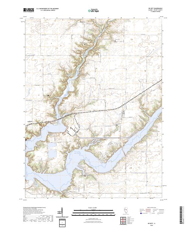
2024 Map of De Witt
USGS Topo · Published 2024About this map
Lake Clinton dominates the southern landscape of this central Illinois quadrangle, its branching arms reaching into the surrounding prairie. The area preserves a dense record of early settlement through several small family and community burial grounds, including Walters Cem, Johnson Cem, and Willmore Cem. The village of De Witt sits at a crossroads just north of the water, while the smaller hamlets of Birkbeck and Solomon are positioned along the county road network. The terrain is largely defined by the drainage of North Fork Salt Creek and Coon Creek, which feed into the larger reservoir system. Recreational and utility infrastructure is evident in features like Sugar Hollow, a local Airport, and the expansive Illinois Power grounds. This modern survey illustrates how 20th-century water management projects have reshaped the traditional agricultural geography of De Witt County.
Find a feature on this map
38 named features on this map. Tap any name to fly to it.
Don’t see what you’re looking for? This feature index may not catch every label — zoom into the map to look around manually.
Map Details
Editions of this 2024 De Witt Map
This is the sole edition of this map. No revisions or reprints were ever made.
Other maps of this area

1937 · Monticello
USGS Topo · 1:48,000

1943 · Monticello
USGS Topo · 1:62,500

1951 · Le Roy
USGS Topo · 1:62,500

1952 · Arrowsmith
USGS Topo · 1:62,500

1957 · Maroa
USGS Topo · 1:62,500

1958 · Peoria
USGS Topo · 1:250,000

1961 · Peoria
USGS Topo · 1:250,000

1963 · Peoria
USGS Topo · 1:250,000
1979 · Maroa
USGS Topo · 1:24,000

1979 · De Witt
USGS Topo · 1:24,000