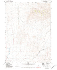
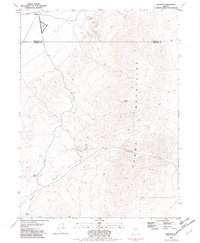
1981 Map of Dead Horse Canyon NE
USGS Topo · Published 1984About this map
Rabbit Hole and the high desert terrain of Pershing County dominate this 1981 survey, reflecting a landscape defined by seasonal water and mining exploration. The western portion of the map is shaped by the broad drainage of Granite Spring Wash, which serves as the primary topographical feature in an area largely devoid of permanent settlements. Resource extraction is suggested by the presence of a Prospect in the northeast corner and the critical infrastructure of the Granite Spring Wash Well, highlighting the importance of water access for those traversing or working this arid environment. The map provides a detailed view of the section lines and township boundaries, including the transition between T 33 N and T 32 N, while several benchmarks like BM 1547.8 anchor the elevation data for the area's unpaved 4WD tracks.
Find a feature on this map
10 named features on this map. Tap any name to fly to it.
Don’t see what you’re looking for? This feature index may not catch every label — zoom into the map to look around manually.
Map Details
Editions of this 1981 Dead Horse Canyon NE Map
2 editions found
Other maps of this area

1931 · Lovelock
USGS Topo · 1:250,000

1935 · Lovelock
USGS Topo · 1:250,000

1955 · Lovelock
USGS Topo · 1:250,000

1959 · Lovelock
USGS Topo · 1:250,000
1981 · Sheep Spring
USGS Topo · 1:24,000
1981 · Dead Horse Canyon
USGS Topo · 1:24,000

1981 · Dead Horse Canyon NE
USGS Topo · 1:24,000

1981 · Placerites
USGS Topo · 1:24,000
1981 · Cholona
USGS Topo · 1:24,000
1981 · Sulphur
USGS Topo · 1:24,000