
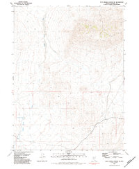
1981 Map of Dead Horse Canyon NE
USGS Topo · Published 1981About this map
Granite Spring Wash defines the western landscape of this high desert terrain in Pershing County. Based on aerial photography from the mid-1970s and field checked in 1975, the map documents a sparse, arid environment where water sources are critical landmarks for survival and navigation. The presence of Granite Spring Wash Well and Granite Spring highlights the importance of reliable water points in the Great Basin region, supporting both local wildlife and potential prospecting activities.
Find a feature on this map
7 named features on this map. Tap any name to fly to it.
Don’t see what you’re looking for? This feature index may not catch every label — zoom into the map to look around manually.
Map Details
Editions of this 1981 Dead Horse Canyon NE Map
2 editions found
Other maps of this area

1931 · Lovelock
USGS Topo · 1:250,000

1935 · Lovelock
USGS Topo · 1:250,000

1955 · Lovelock
USGS Topo · 1:250,000

1959 · Lovelock
USGS Topo · 1:250,000
1981 · Sheep Spring
USGS Topo · 1:24,000
1981 · Dead Horse Canyon
USGS Topo · 1:24,000

1981 · Placerites
USGS Topo · 1:24,000
1981 · Cholona
USGS Topo · 1:24,000
1981 · Sulphur
USGS Topo · 1:24,000
1981 · Rabbithole
USGS Topo · 1:24,000