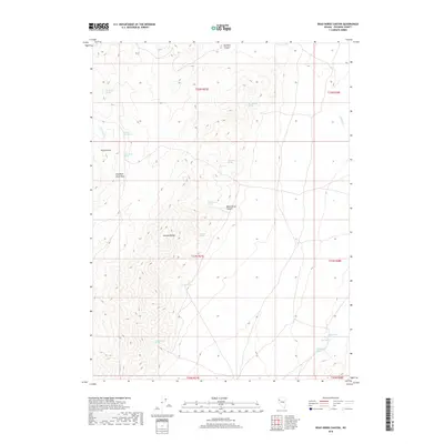
2018 Map of Dead Horse Canyon
USGS Topo · Published 2018About this map
Hannan Range dominates the central portion of this Pershing County landscape, where desert hydrology is defined by a series of isolated water sources. Named springs like Tarantula Spring, Scorpion Spring, and Dead Horse Spring indicate the critical importance of water access in this high-desert environment. The topography is deeply carved by drainage systems including Dead Horse Canyon and Rockhill Canyon, while distinct geological markers such as Elephant Head Rock provide essential navigation points. This survey illustrates the sparse, undeveloped character of the region, where seasonal watercourses like Willow Cr and Lava Beds Cr segment the terrain between the ranges. To the south, additional sources such as Rattlesnake Spring and White Horse Spring further emphasize the network of springs that historically supported movement through this arid part of Nevada.
Find a feature on this map
25 named features on this map. Tap any name to fly to it.
Don’t see what you’re looking for? This feature index may not catch every label — zoom into the map to look around manually.
Map Details
Editions of this 2018 Dead Horse Canyon Map
This is the sole edition of this map. No revisions or reprints were ever made.
Other maps of this area

1886 · Granite Range
USGS Topo · 1:250,000

1894 · Granite Range
USGS Topo · 1:250,000

1931 · Lovelock
USGS Topo · 1:250,000

1935 · Lovelock
USGS Topo · 1:250,000

1955 · Lovelock
USGS Topo · 1:250,000

1959 · Lovelock
USGS Topo · 1:250,000

1980 · Eagle Rock Spring
USGS Topo · 1:24,000

1980 · Dry Mountain
USGS Topo · 1:24,000
1981 · Sheep Spring
USGS Topo · 1:24,000

1981 · Twin Buttes Well
USGS Topo · 1:24,000