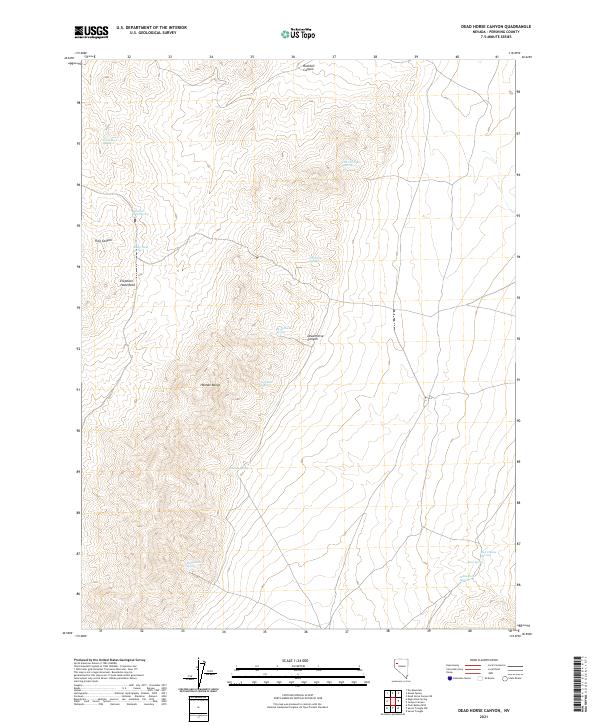
2021 Map of Dead Horse Canyon
USGS Topo · Published 2021About this map
Hannan Range anchors this arid Pershing County landscape, where the distribution of water sources dictates the geography of human and animal movement. The map records a series of named water points including Turtle Rock Spring, Scorpion Spring, and Rattlesnake Spring, which have long served as vital landmarks in the high desert. To the north, Rockhill Canyon cuts through the terrain near the distinctively named Elephant Head Rock, while Dead Horse Canyon provides a natural corridor through the central portion of the sheet. The high density of springs such as Five Troughs Springs and Tarantula Spring suggests a landscape where these specific locations were essential for livestock or early travel routes. This survey provides a precise modern look at the remote topography of the Great Basin, capturing the elevations and named natural features that remain central to the region's character.
Find a feature on this map
23 named features on this map. Tap any name to fly to it.
Don’t see what you’re looking for? This feature index may not catch every label — zoom into the map to look around manually.
Map Details
Editions of this 2021 Dead Horse Canyon Map
This is the sole edition of this map. No revisions or reprints were ever made.
Other maps of this area

1886 · Granite Range
USGS Topo · 1:250,000

1894 · Granite Range
USGS Topo · 1:250,000

1931 · Lovelock
USGS Topo · 1:250,000

1935 · Lovelock
USGS Topo · 1:250,000

1955 · Lovelock
USGS Topo · 1:250,000

1959 · Lovelock
USGS Topo · 1:250,000

1980 · Eagle Rock Spring
USGS Topo · 1:24,000

1980 · Dry Mountain
USGS Topo · 1:24,000
1981 · Sheep Spring
USGS Topo · 1:24,000

1981 · Twin Buttes Well
USGS Topo · 1:24,000