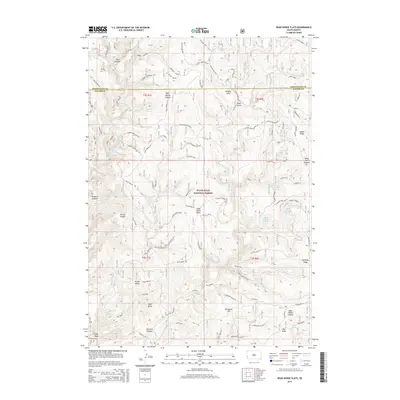
2015 Map of Dead Horse Flats
USGS Topo · Published 2015About this map
Black Hills National Forest land defines this portion of the South Dakota high country, where the landscape is carved by deep drainages like Redbird Canyon and Gillette Canyon. The central upland known as Dead Horse Flats serves as a geographic anchor, surrounded by numerous vital water sources including Dead Horse Spring, Wells Spring, and Blowout Spring. The terrain transitions from prominent landmarks such as Yellow Butte and Red Butte in the south to the high breaks of Wilson Divide in the north. The area is interlaced with named routes like the Gillette Divide Cut-Off and Dead Horse Rd, which follow the natural contours of the ridges and canyon floors. This survey documents a complex network of draws and springs essential for managing livestock and forest resources in Pennington and Custer counties.
Find a feature on this map
55 named features on this map. Tap any name to fly to it.
Don’t see what you’re looking for? This feature index may not catch every label — zoom into the map to look around manually.
Map Details
Editions of this 2015 Dead Horse Flats Map
This is the sole edition of this map. No revisions or reprints were ever made.
Other maps of this area

1896 · Harney Peak
USGS Topo · 1:125,000

1899 · Newcastle
USGS Topo · 1:125,000

1901 · Harney Peak
USGS Topo · 1:125,000

1901 · Newcastle
USGS Topo · 1:125,000

1951 · Fanny Peak
USGS Topo · 1:24,000

1951 · Clifton
USGS Topo · 1:24,000

1955 · Dead Horse Flats
USGS Topo · 1:24,000

1955 · Jewel Cave NW
USGS Topo · 1:24,000

1955 · Jewel Cave
USGS Topo · 1:24,000

1955 · Signal Hill
USGS Topo · 1:24,000