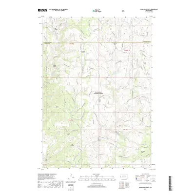
2017 Map of Dead Horse Flats
USGS Topo · Published 2017About this map
The Black Hills National Forest defines the rugged topography of this region along the Pennington and Custer county line. The landscape is a network of ridges and canyons, most notably Gillette Canyon and Redbird Canyon, which are punctuated by isolated peaks such as Yellow Butte and Red Butte. Water sources are critical markers across this terrain, with numerous named springs like Gooseberry Spring, Dead Horse Spring, and Ellis Spring providing vital points of reference in the high country.
Find a feature on this map
51 named features on this map. Tap any name to fly to it.
Don’t see what you’re looking for? This feature index may not catch every label — zoom into the map to look around manually.
Map Details
Editions of this 2017 Dead Horse Flats Map
This is the sole edition of this map. No revisions or reprints were ever made.
Other maps of this area

1896 · Harney Peak
USGS Topo · 1:125,000

1899 · Newcastle
USGS Topo · 1:125,000

1901 · Harney Peak
USGS Topo · 1:125,000

1901 · Newcastle
USGS Topo · 1:125,000

1951 · Fanny Peak
USGS Topo · 1:24,000

1951 · Clifton
USGS Topo · 1:24,000

1955 · Dead Horse Flats
USGS Topo · 1:24,000

1955 · Jewel Cave NW
USGS Topo · 1:24,000

1955 · Jewel Cave
USGS Topo · 1:24,000

1955 · Signal Hill
USGS Topo · 1:24,000