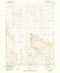
1951 Map of Dead Horse Springs
USGS Topo · Published 1973About this map
Dead Horse Springs and the winding Dead Horse Draw define this high plains landscape on the Colorado border of Morgan and Weld counties. Surveyed in the early 1950s, the map reveals a remote pastoral territory where water management is the primary driver of development. The southern corner is marked by significant irrigation infrastructure, including the Riverside Canal and the Riverside Ditch, which support the agricultural life of the region. Scattered throughout the townships are numerous Windmills, indicating a reliance on groundwater for livestock across the undulating terrain.
Find a feature on this map
10 named features on this map. Tap any name to fly to it.
Don’t see what you’re looking for? This feature index may not catch every label — zoom into the map to look around manually.
Map Details
Editions of this 1951 Dead Horse Springs Map
4 editions found
Other maps of this area

1951 · Dead Horse Springs
USGS Topo · 1:24,000

1951 · Brush West
USGS Topo · 1:24,000

1951 · Antelope Springs
USGS Topo · 1:24,000

1951 · Brush East
USGS Topo · 1:24,000

1951 · Peace Valley School
USGS Topo · 1:24,000

1951 · Fort Morgan
USGS Topo · 1:24,000

1954 · Sterling
USGS Topo · 1:250,000

1958 · Sterling
USGS Topo · 1:250,000

1971 · Brush East
USGS Topo · 1:24,000
1971 · Brush West
USGS Topo · 1:24,000