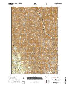
2020 Map of Deadhorse Ridge
USGS Topo · Published 2020About this map
Wallowa National Forest dominates this high-elevation landscape where the borders of Oregon and Idaho meet at the confluence of several major waterways. The eastern boundary is defined by the Snake Wild and Scenic River, where significant river features like Mountain Sheep Rapids and Bear Creek Rapids reveal the power of the corridor. Along the river's edge, Eureka Bar sits below the steep heights of Wapshilla Ridge and Craig Mtn. Centered on the map is the prominent Deadhorse Ridge and Deadhorse Butte, which serve as a massive divide between the Eureka Creek drainage to the east and the S Fork Chesnimnus Cr to the south. The junction of the Imnaha River and the Snake River creates a complex series of gulches and draws, including Hilliker Gulch and Trough Gulch, reflecting the deeply eroded geology of this tri-county intersection.
Find a feature on this map
51 named features on this map. Tap any name to fly to it.
Don’t see what you’re looking for? This feature index may not catch every label — zoom into the map to look around manually.
Map Details
Editions of this 2020 Deadhorse Ridge Map
This is the sole edition of this map. No revisions or reprints were ever made.
Other maps of this area

1954 · Imnaha
USGS Topo · 1:62,500

1954 · Kernan Point
USGS Topo · 1:62,500

1955 · Grangeville
USGS Topo · 1:250,000

1959 · Grangeville
USGS Topo · 1:250,000

1963 · Cactus Mtn
USGS Topo · 1:24,000

1963 · Deadhorse Ridge
USGS Topo · 1:24,000

1963 · Jim Creek Butte
USGS Topo · 1:24,000

1963 · Rattlesnake Ridge
USGS Topo · 1:24,000

1963 · Wapshilla Creek
USGS Topo · 1:24,000

1963 · Poison Point
USGS Topo · 1:24,000