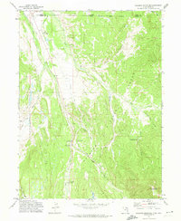
1972 Map of Deadman Mountain
USGS Topo · Published 1974About this map
The Wasatch National Forest defines the high-altitude landscape of this 1970s survey, where the Bear River and its various forks and canals create a complex hydraulic network across the Utah and Wyoming border. This area serves as a significant intersection of recreational and ranching land use, evidenced by the presence of the Hill Air Force Base Recreation Camp and traditional properties like Burts-Miller Ranch and Island Ranch. The map captures the infrastructure of water management in the region, featuring the Hilliard Canal and Hilliard East Fork Canal, which navigate the terrain alongside notable peaks such as Lone Mountain and the eponymous Deadman Mountain. Managed access is indicated by the Bear River Ranger Sta and seasonal sites like Bear River Campground, while more remote pockets are marked by the Grassy Lakes and a network of jeep trails reaching into the mountain draws.
Find a feature on this map
28 named features on this map. Tap any name to fly to it.
Don’t see what you’re looking for? This feature index may not catch every label — zoom into the map to look around manually.
Map Details
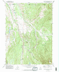
Editions of this 1972 Deadman Mountain Map
2 editions found
Other maps of this area

1885 · Uinta
USGS Topo · 1:250,000

1901 · Hayden Peak
USGS Topo · 1:125,000

1903 · Hayden Peak
USGS Topo · 1:125,000

1954 · Salt Lake City
USGS Topo · 1:250,000

1954 · Ogden
USGS Topo · 1:250,000

1958 · Ogden
USGS Topo · 1:250,000

1958 · Salt Lake City
USGS Topo · 1:250,000

1960 · Ogden
USGS Topo · 1:250,000

1960 · Salt Lake City
USGS Topo · 1:250,000

1965 · Myers Reservoir
USGS Topo · 1:24,000