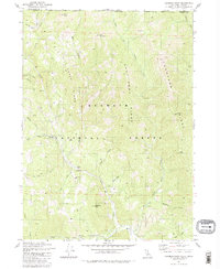
1981 Map of Deadman Point
USGS Topo · Published 1981About this map
The high ridges of the Klamath National Forest define the landscape of this 1981 survey along the California-Oregon border. Mineral extraction is a prominent theme in this terrain, with several specific sites identified including the Huey Mine, County Mine, and Classic Hill Mine clustered along the western slopes. Further east, the Jade Mine and Wood Mine indicate a diverse geological interest in these mountains.
Find a feature on this map
46 named features on this map. Tap any name to fly to it.
Don’t see what you’re looking for? This feature index may not catch every label — zoom into the map to look around manually.
Map Details
Editions of this 1981 Deadman Point Map
3 editions found
Other maps of this area

1908 · Grants Pass
USGS Topo · 1:125,000

1914 · Seiad
USGS Topo · 1:125,000

1917 · Kerby
USGS Topo · 1:125,000

1918 · Kerby
USGS Topo · 1:125,000

1922 · Preston Peak
USGS Topo · 1:125,000

1922 · Seiad
USGS Topo · 1:125,000

1945 · Kerby
USGS Topo · 1:125,000

1948 · Weed
USGS Topo · 1:250,000

1950 · Weed
USGS Topo · 1:250,000

1954 · Cave Junction
USGS Topo · 1:62,500