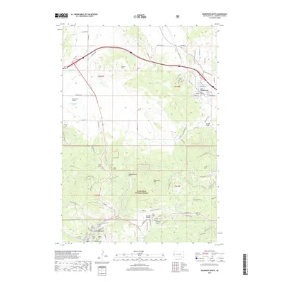
2017 Map of Deadwood North
USGS Topo · Published 2017About this map
Deadwood anchors the southern portion of this landscape, its urban grid squeezed between the ridges of the Black Hills National Forest. The map documents a territory defined by complex topography and historic burial sites, including the Seth Bullock Grave and Mount Moriah Cem overlooking the town. Further north, the settlement of Whitewood serves as a gateway to the broader plains of Centennial Prairie, marking a distinct shift from the wooded heights to open ranchland. To the east, Crook City and Mountain Meadow represent smaller clusters of development along the foothills. The terrain is marked by numerous named drainages such as Whitewood Cr and Sandy Cr, which descend from summits like Crook Mtn and Whitewood Peak. The distribution of rural cemeteries, such as Anderson Cem and Oak Ridge Cem, provides a detailed record of local genealogy across this diverse South Dakota landscape.
Find a feature on this map
93 named features on this map. Tap any name to fly to it.
Don’t see what you’re looking for? This feature index may not catch every label — zoom into the map to look around manually.
Map Details
Editions of this 2017 Deadwood North Map
This is the sole edition of this map. No revisions or reprints were ever made.
Other maps of this area

1894 · Deadwood
USGS Topo · 1:125,000

1899 · Sturgis
USGS Topo · 1:62,500

1900 · Spearfish
USGS Topo · 1:62,500

1901 · Deadwood
USGS Topo · 1:125,000

1905 · Saint Onge
USGS Topo · 1:62,500

1907 · Belle Fourche
USGS Topo · 1:125,000

1907 · Redwater
USGS Topo · 1:62,500

1915 · Spearfish
USGS Topo · 1:62,500

1915 · Sturgis
USGS Topo · 1:62,500

1916 · Deadwood
USGS Topo · 1:125,000