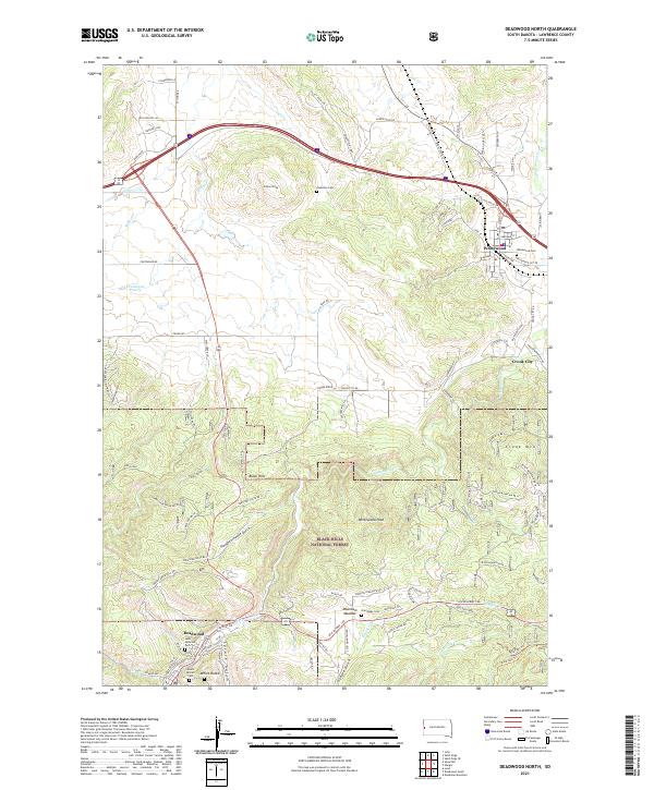
2021 Map of Deadwood North
USGS Topo · Published 2021About this map
Deadwood and the northern reaches of the Black Hills National Forest anchor this landscape, where the town's urban grid transitions into the steep terrain of Spruce Gulch and Slaughterhouse Gulch. Several historic burial sites, including the notable Mount Moriah Cem and Saint Ambrose Cem, offer significant genealogical value for those tracing the families of the gold-mining era. The map follows the northeasterly course of Whitewood Creek as it moves toward the settlements of Crook City and Whitewood, reflecting the late-nineteenth-century pattern of development along water and rail corridors. High points such as Elkhorn Peak and White Rocks dominate the local horizon, while features like Mountain Meadow and Centennial Prairie indicate the scattered agricultural and open-space clearances within the dense forest. This topographic study clarifies the spatial relationship between the early mining hub and the surrounding ranching and transport networks along US Highway 14A.
Find a feature on this map
96 named features on this map. Tap any name to fly to it.
Don’t see what you’re looking for? This feature index may not catch every label — zoom into the map to look around manually.
Map Details
Editions of this 2021 Deadwood North Map
This is the sole edition of this map. No revisions or reprints were ever made.
Other maps of this area

1894 · Deadwood
USGS Topo · 1:125,000

1899 · Sturgis
USGS Topo · 1:62,500

1900 · Spearfish
USGS Topo · 1:62,500

1901 · Deadwood
USGS Topo · 1:125,000

1905 · Saint Onge
USGS Topo · 1:62,500

1907 · Belle Fourche
USGS Topo · 1:125,000

1907 · Redwater
USGS Topo · 1:62,500

1915 · Spearfish
USGS Topo · 1:62,500

1915 · Sturgis
USGS Topo · 1:62,500

1916 · Deadwood
USGS Topo · 1:125,000