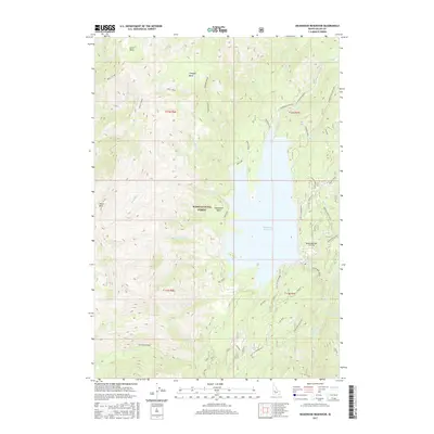
2017 Map of Deadwood Reservoir
USGS Topo · Published 2017About this map
Deadwood Reservoir dominates this high-altitude landscape within the Boise National Forest, serving as a focal point for water management and wilderness access in Valley County. The 2017 topography illustrates the complex drainage system feeding the reservoir, including the Deadwood River, Habit Cr, and Bummer Creek. Key infrastructure like the Deadwood Dam and an adjacent Airstrip provide essential access and control within this roadless-oriented terrain.
Find a feature on this map
44 named features on this map. Tap any name to fly to it.
Don’t see what you’re looking for? This feature index may not catch every label — zoom into the map to look around manually.
Map Details
Editions of this 2017 Deadwood Reservoir Map
This is the sole edition of this map. No revisions or reprints were ever made.
Other maps of this area

1909 · Garden Valley
USGS Topo · 1:125,000

1953 · Boiling Springs
USGS Topo · 1:62,500

1953 · Deadwood Reservoir
USGS Topo · 1:62,500

1957 · Challis
USGS Topo · 1:250,000

1959 · Garden Valley
USGS Topo · 1:62,500

1960 · Challis
USGS Topo · 1:250,000

1963 · Challis
USGS Topo · 1:250,000

1972 · Scott Creek
USGS Topo · 1:24,000
1972 · Miller Mtn West
USGS Topo · 1:24,000

1982 · Deadwood River
USGS Topo · 1:100,000