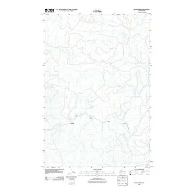
2011 Map of Dean Creek
USGS Topo · Published 2011About this map
The Fall River and its numerous tributaries, including Wilson Creek and Brush Creek, define the topography of this corner of Pacific County. In the early 21st century, these drainage basins were marked by a sparse network of forest roads and small, isolated settlements that speak to the region's timber and maritime heritage. The small community of Burt sits near the confluence of Elk Creek and Little Elk Creek, while other small hubs such as Bedford and Davis are scattered along the local valleys. Notable transport routes like Monohan Landing Rd and the Port Blakely area hint at historical logging operations and access points to the river systems. This landscape is a complex web of seasonal and perennial streams, including Fourth Creek and Swem Creek, which feed into the larger waterways that have long supported the local economy.
Find a feature on this map
19 named features on this map. Tap any name to fly to it.
Don’t see what you’re looking for? This feature index may not catch every label — zoom into the map to look around manually.
Map Details
Editions of this 2011 Dean Creek Map
This is the sole edition of this map. No revisions or reprints were ever made.
Other maps of this area

1940 · Montesano
USGS Topo · 1:62,500

1941 · Walville
USGS Topo · 1:62,500

1941 · Ford
USGS Topo · 1:62,500

1953 · Hoquiam
USGS Topo · 1:250,000

1953 · Pe Ell
USGS Topo · 1:62,500

1953 · Malone
USGS Topo · 1:62,500

1955 · Montesano
USGS Topo · 1:62,500

1955 · Raymond
USGS Topo · 1:62,500

1957 · Hoquiam
USGS Topo · 1:250,000

1958 · Hoquiam
USGS Topo · 1:250,000