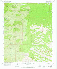
1968 Map of Dean Peak
USGS Topo · Published 1972About this map
The high elevations of the Hualapai Mountains anchor this late-1960s survey, defined by a complex network of resource extraction and mountain water sources. Hard-rock mining history is evident through the presence of the Standard Mineral Mine in the north and the Mica Giant Mine and Gold King Mine to the south. This rugged landscape served both industry and early recreation, with the Hualapai Mountain County Park and a designated Campground providing mountain access near Pine Lake. Below the 8,012-foot summit of Dean Peak, the terrain is carved by numerous washes such as Antelope Wash and Moss Wash, which are fed by vital local water points like New Years Cabin Spring and Stokes Well. The infrastructure of the era is represented by a series of pack and jeep trails connecting remote locations like Oaks Ranch to high-altitude tanks and corrals.
Find a feature on this map
40 named features on this map. Tap any name to fly to it.
Don’t see what you’re looking for? This feature index may not catch every label — zoom into the map to look around manually.
Map Details
Editions of this 1968 Dean Peak Map
3 editions found
Other maps of this area

1886 · Diamond Creek
USGS Topo · 1:250,000

1892 · Diamond Creek
USGS Topo · 1:250,000

1923 · Signal
USGS Topo · 1:250,000

1942 · Signal
USGS Topo · 1:250,000

1948 · Williams
USGS Topo · 1:250,000

1950 · Prescott
USGS Topo · 1:250,000

1954 · Prescott
USGS Topo · 1:250,000

1954 · Williams
USGS Topo · 1:250,000

1956 · Williams
USGS Topo · 1:250,000

1958 · Prescott
USGS Topo · 1:250,000