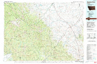
1993 Map of Dearborn River
USGS Topo · Published 1993About this map
The Lewis and Clark Range dominates this 1993 study of the Montana high country, where the Continental Divide winds between the Scapegoat Wilderness and the Bob Marshall Wilderness. This area represents a massive protected landscape at the convergence of the Lewis and Clark National Forest, the Helena National Forest, and the Lolo National Forest. While the western portion is defined by peaks like Red Mountain and Silver King Mountain, the eastern section transitions into the high plains and ranching country around Augusta. Evidence of the region's wilderness management and recreational infrastructure is clear through the path of the Continental Divide Trail and the presence of the Blackfoot-Clearwater State Wildlife Management Area. Water resources are a central feature, from the headwaters of the Dearborn River and Landers Fork to the Nilan Reservoir and the glacial Bean Lake.
Find a feature on this map
120 named features on this map. Tap any name to fly to it.
Don’t see what you’re looking for? This feature index may not catch every label — zoom into the map to look around manually.
Map Details
Editions of this 1993 Dearborn River Map
This is the sole edition of this map. No revisions or reprints were ever made.
Other maps of this area

1886 · Great Falls
USGS Topo · 1:250,000

1886 · Fort Logan
USGS Topo · 1:250,000

1889 · Helena
USGS Topo · 1:250,000

1893 · Helena
USGS Topo · 1:250,000

1899 · Helena
USGS Topo · 1:250,000

1902 · Ovando
USGS Topo · 1:125,000

1903 · Saypo
USGS Topo · 1:125,000

1903 · Coopers Lake
USGS Topo · 1:125,000

1903 · Helena
USGS Topo · 1:250,000

1905 · Ovando
USGS Topo · 1:125,000