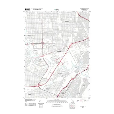
2011 Map of Dearborn
USGS Topo · Published 2011About this map
The industrial and educational heart of Wayne County comes into focus on this 2011 survey, centered on the city of Dearborn. The landscape is dominated by the winding path of the River Rouge, which flows past the University of Michigan - Dearborn and the expansive grounds of Greenfield Village. This area reflects a dense urban fabric where historic residential patterns meet massive industrial infrastructure, particularly evident near the confluence of the Lower River Rouge and the main channel. Large burial grounds including Evergreen Cemetery, Holy Cross Cemetery, and Woodmere Cemetery provide significant open space and genealogical interest within the tight-knit street grids of Detroit and Melvindale. The map also details the complex hydrology of the region, from the Ecorse River in the south to the isolated Fordson Island, illustrating the long-standing relationship between the region's river systems and its heavy industrial development.
Find a feature on this map
33 named features on this map. Tap any name to fly to it.
Don’t see what you’re looking for? This feature index may not catch every label — zoom into the map to look around manually.
Map Details
Editions of this 2011 Dearborn Map
This is the sole edition of this map. No revisions or reprints were ever made.
Other maps of this area

1905 · Wayne
USGS Topo · 1:62,500

1905 · Detroit
USGS Topo · 1:62,500

1906 · Wyandotte
USGS Topo · 1:62,500

1906 · Romulus
USGS Topo · 1:62,500

1912 · Wyandotte
USGS Topo · 1:62,500

1912 · Wayne
USGS Topo · 1:62,500

1918 · Detroit
USGS Topo · 1:62,500

1924 · Detroit
USGS Topo · 1:62,500

1928 · Romulus
USGS Topo · 1:62,500

1929 · Wyandotte
USGS Topo · 1:62,500