Loading...
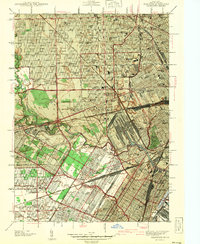
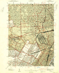
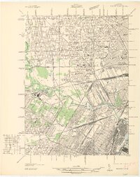
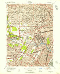
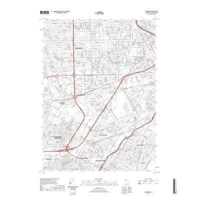
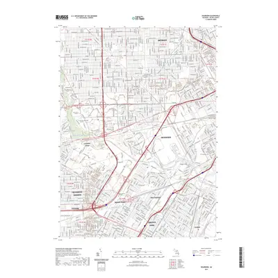
Loading map...1942 Map of Dearborn
USGS Topo · Published 1942About this map
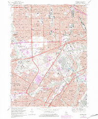
The industrial and civic heart of the City of Dearborn dominates this 1940s landscape, illustrating the rapid maturation of a manufacturing powerhouse. Centered on the Rouge River and the expansive grounds of the Ford Museum, the map captures the transition from open fields to dense residential grids. The presence of Greenfield Village and the Ford Rotunda adjacent to the Ford Airport underscores the area's role as a global hub of innovation and history.
Find a feature on this map
114 named features on this map. Tap any name to fly to it.
Don’t see what you’re looking for? This feature index may not catch every label — zoom into the map to look around manually.
Map Details
Date Portrayed1942
Date Published1942
PublisherU.S. Geological Survey
Map TypeTopographic
Scale1:24,000
Physical Dimensions21.9 x 26.8 inches
Editions of this 1942 Dearborn Map
2 editions found
Historical Maps of Detroit Through Time
9 maps found
Featured Locations
Source Details
SourceU.S. Geological Survey
CopyrightPublic Domain