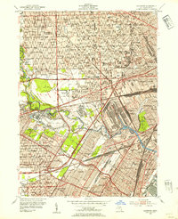
1952 Map of Dearborn
USGS Topo · Published 1954About this map
Greenfield Village and the massive industrial infrastructure of the Rouge River basin dominate this mid-century look at the American automotive heartland. The landscape is a dense network of major transportation corridors, including the Edsel Ford Expressway and multiple railroad lines like the New York Central RR and Wabash RR. The map captures the height of the industrial era, showing a landscape tightly integrated with the car industry, from the Ford Rotunda to the Proving Ground south of the Lower Rouge River.
Find a feature on this map
130 named features on this map. Tap any name to fly to it.
Don’t see what you’re looking for? This feature index may not catch every label — zoom into the map to look around manually.
Map Details
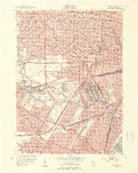
Editions of this 1952 Dearborn Map
2 editions found
Other maps of this area

1905 · Wayne
USGS Topo · 1:62,500

1905 · Detroit
USGS Topo · 1:62,500

1906 · Wyandotte
USGS Topo · 1:62,500

1906 · Romulus
USGS Topo · 1:62,500

1912 · Wyandotte
USGS Topo · 1:62,500

1912 · Wayne
USGS Topo · 1:62,500

1918 · Detroit
USGS Topo · 1:62,500

1924 · Detroit
USGS Topo · 1:62,500

1928 · Romulus
USGS Topo · 1:62,500

1929 · Wyandotte
USGS Topo · 1:62,500