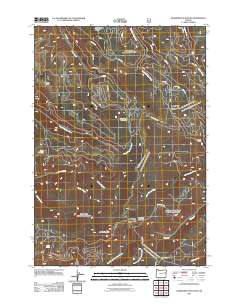
2011 Map of Deardorff Mountain
USGS Topo · Published 2011About this map
Deardorff Mountain and Baldy Mountain dominate this high-elevation terrain in Baker County, where a complex network of forest service roads provides access to the headwaters of several major drainages. The landscape is defined by its water sources, from seasonal flows at Deadman Gulch to established perennial points like Kline Spring and Alder Spring. A series of forest roads, such as NFS 2835 RD and NFD RD 2652 RD, snake through the ridges to connect remote landmarks like Little Squaw Meadow and Grouse Knob. The map reveals a transition of water flow as Clear Creek and North Reynolds Creek carve through the northern slopes, while the southern reaches are fed by North Fork Deardorff Creek and South Fork Deardorff Creek. Looney Spring Campground serves as a central point for those navigating this isolated portion of the Blue Mountains region.
Find a feature on this map
36 named features on this map. Tap any name to fly to it.
Don’t see what you’re looking for? This feature index may not catch every label — zoom into the map to look around manually.
Map Details
Editions of this 2011 Deardorff Mountain Map
This is the sole edition of this map. No revisions or reprints were ever made.
Other maps of this area

1901 · Sumpter
USGS Topo · 1:125,000

1908 · Ironside Mountain
USGS Topo · 1:125,000

1951 · Bates
USGS Topo · 1:62,500

1955 · Canyon City
USGS Topo · 1:250,000

1959 · Canyon City
USGS Topo · 1:250,000

1959 · Prairie City
USGS Topo · 1:62,500

1972 · Austin
USGS Topo · 1:24,000
1972 · Deardorff Mtn
USGS Topo · 1:24,000
1972 · Bullrun Rock
USGS Topo · 1:24,000
1972 · Rail Gulch
USGS Topo · 1:24,000