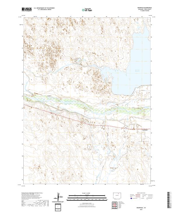
2022 Map of Dearfield
USGS Topo · Published 2022About this map
The South Platte River corridor in Weld County reveals a landscape defined by an intricate network of irrigation and water management infrastructure. This 2022 survey captures the engineering required to sustain the high plains, featuring the large Riverside Reservoir and a system of waterways including the Riverside Intake Canal, Bijou Canal, and Empire Intake Canal. These features highlight the region's long-standing reliance on diverted river water for agriculture and settlement.
Find a feature on this map
21 named features on this map. Tap any name to fly to it.
Don’t see what you’re looking for? This feature index may not catch every label — zoom into the map to look around manually.
Map Details
Editions of this 2022 Dearfield Map
This is the sole edition of this map. No revisions or reprints were ever made.
Other maps of this area

1950 · Greasewood Lake
USGS Topo · 1:24,000

1950 · Tampa
USGS Topo · 1:24,000

1950 · Barnesville
USGS Topo · 1:24,000

1950 · Masters
USGS Topo · 1:24,000

1950 · Hardin
USGS Topo · 1:24,000

1951 · Masters
USGS Topo · 1:24,000

1951 · Hardin
USGS Topo · 1:24,000

1951 · Roggen
USGS Topo · 1:24,000

1951 · Omar
USGS Topo · 1:24,000

1951 · Point Of Rocks
USGS Topo · 1:24,000