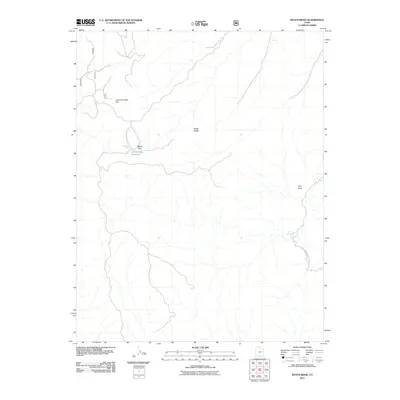
2011 Map of Death Ridge
USGS Topo · Published 2011About this map
Death Ridge and the high plateaus of Kane County define this landscape as it appeared in 2011, dominated by vast public lands and sparse water sources. The map provides a detailed view of the borderlands near Glen Canyon National Park, where the survival of cattle and wildlife depends on isolated features like Mossy Dell Spring and Death Ridge Reservoir. The terrain is characterized by high flats and hidden seeps, such as Lonesome Pine Flat and Star Seep, which have likely served as vital landmarks for generations of ranchers and hunters in this part of southern Utah. The inclusion of Camp Spring further emphasizes the necessity of mapped water points in this arid environment, capturing a moment when these traditional landmarks remained essential to navigating the backcountry.
Find a feature on this map
8 named features on this map. Tap any name to fly to it.
Don’t see what you’re looking for? This feature index may not catch every label — zoom into the map to look around manually.
Map Details
Editions of this 2011 Death Ridge Map
This is the sole edition of this map. No revisions or reprints were ever made.
Other maps of this area

1886 · Escalante
USGS Topo · 1:250,000

1922 · Upper Last Chance
USGS Topo · 1:63,360

1956 · Escalante
USGS Topo · 1:250,000

1960 · Escalante
USGS Topo · 1:250,000

1964 · Dave Canyon
USGS Topo · 1:24,000

1964 · Canaan Creek
USGS Topo · 1:24,000

1964 · Canaan Peak
USGS Topo · 1:24,000

1964 · Death Ridge
USGS Topo · 1:24,000

1964 · Carcass Canyon
USGS Topo · 1:24,000
1964 · Butler Valley
USGS Topo · 1:24,000