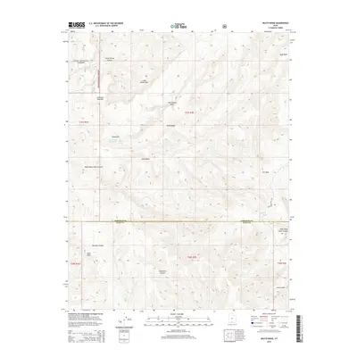
2014 Map of Death Ridge
USGS Topo · Published 2014About this map
Dixie National Forest boundaries encompass the western portion of this high-desert landscape, where the terrain is defined by a complex network of canyons and washes. The central prominence of Death Ridge serves as a watershed divide, with seasonal drainages like Alvey Wash and Trap Canyon Wash cutting through the topography. In an environment defined by aridity, specific water sources such as Mossy Dell Spring, Camp Spring, and the Death Ridge Reservoir are significant localized landmarks. The presence of Lonesome Pine Flat and Mossy Dell indicates pockets of distinct vegetation or sheltered topography amidst the larger canyon systems. Remote access is primarily provided by Smokey Mountain Rd, which skirts the eastern edge of the quadrangle near Star Seep. This geography highlights the transition between the high forest lands and the deeply eroded corridors of Escalante Canyon and Right Hand Collet Canyon to the south.
Find a feature on this map
24 named features on this map. Tap any name to fly to it.
Don’t see what you’re looking for? This feature index may not catch every label — zoom into the map to look around manually.
Map Details
Editions of this 2014 Death Ridge Map
This is the sole edition of this map. No revisions or reprints were ever made.
Other maps of this area

1886 · Escalante
USGS Topo · 1:250,000

1922 · Upper Last Chance
USGS Topo · 1:63,360

1956 · Escalante
USGS Topo · 1:250,000

1960 · Escalante
USGS Topo · 1:250,000

1964 · Dave Canyon
USGS Topo · 1:24,000

1964 · Canaan Creek
USGS Topo · 1:24,000

1964 · Canaan Peak
USGS Topo · 1:24,000

1964 · Death Ridge
USGS Topo · 1:24,000

1964 · Carcass Canyon
USGS Topo · 1:24,000
1964 · Butler Valley
USGS Topo · 1:24,000