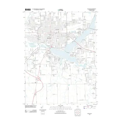
2012 Map of Decatur
USGS Topo · Published 2012About this map
Decatur is defined by its deep relationship with the Sangamon River, which feeds the expansive Lake Decatur that dominates the central portion of this map. The city's industrial and academic identity is represented by Millikin University and the specialized infrastructure of the A E Staley Cooling Lake. For genealogists and local researchers, the map is remarkably dense with burial grounds, ranging from the large Greenwood Cem and Graceland Cem near the city center to smaller sites like Spangler Cem and Mount Zion Presbyterian Cem to the southeast.
Find a feature on this map
154 named features on this map. Tap any name to fly to it.
Don’t see what you’re looking for? This feature index may not catch every label — zoom into the map to look around manually.
Map Details
Editions of this 2012 Decatur Map
This is the sole edition of this map. No revisions or reprints were ever made.
Other maps of this area

1929 · Decatur
USGS Topo · 1:62,500

1933 · Decatur
USGS Topo · 1:62,500

1949 · Dalton City
USGS Topo · 1:62,500

1952 · Assumption
USGS Topo · 1:62,500

1954 · Niantic
USGS Topo · 1:62,500

1958 · Decatur
USGS Topo · 1:250,000

1961 · Decatur
USGS Topo · 1:250,000

1967 · Long Creek
USGS Topo · 1:24,000
1967 · Argenta
USGS Topo · 1:24,000

1967 · Decatur
USGS Topo · 1:24,000