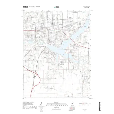
2021 Map of Decatur
USGS Topo · Published 2021About this map
The Sangamon River corridor and its expansive reservoir, Lake Decatur, define the landscape of this central Illinois quadrangle. The city of Decatur occupies the northern half, showing a dense street grid that includes Millikin University and significant infrastructure such as the Staley Bridge and Macon County Bridge. Industrial and local history interests are centered around the Staley Cooling Lake and the complex web of neighborhoods branching off W Eldorado St and W North St.
Find a feature on this map
264 named features on this map. Tap any name to fly to it.
Don’t see what you’re looking for? This feature index may not catch every label — zoom into the map to look around manually.
Map Details
Editions of this 2021 Decatur Map
This is the sole edition of this map. No revisions or reprints were ever made.
Other maps of this area

1929 · Decatur
USGS Topo · 1:62,500

1933 · Decatur
USGS Topo · 1:62,500

1949 · Dalton City
USGS Topo · 1:62,500

1952 · Assumption
USGS Topo · 1:62,500

1954 · Niantic
USGS Topo · 1:62,500

1958 · Decatur
USGS Topo · 1:250,000

1961 · Decatur
USGS Topo · 1:250,000

1967 · Long Creek
USGS Topo · 1:24,000
1967 · Argenta
USGS Topo · 1:24,000

1967 · Decatur
USGS Topo · 1:24,000