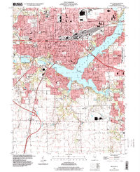
1998 Map of Decatur
USGS Topo · Published 2000About this map
The Sangamon River valley and its expansion into Lake Decatur dominate this detailed late-twentieth-century study of the Macon County landscape. The city of Decatur is shown in its full urban extent, characterized by a dense network of neighborhoods, civic institutions, and the Illinois Central Railroad corridor. Large-scale residential and educational developments define the western and southern reaches, including the campus of Millikin University and various parochial and public schools such as St Teresa Academy and MacArthur High Sch.
Find a feature on this map
72 named features on this map. Tap any name to fly to it.
Don’t see what you’re looking for? This feature index may not catch every label — zoom into the map to look around manually.
Map Details
Editions of this 1998 Decatur Map
This is the sole edition of this map. No revisions or reprints were ever made.
Other maps of this area

1929 · Decatur
USGS Topo · 1:62,500

1933 · Decatur
USGS Topo · 1:62,500

1949 · Dalton City
USGS Topo · 1:62,500

1952 · Assumption
USGS Topo · 1:62,500

1954 · Niantic
USGS Topo · 1:62,500

1958 · Decatur
USGS Topo · 1:250,000

1961 · Decatur
USGS Topo · 1:250,000

1967 · Long Creek
USGS Topo · 1:24,000
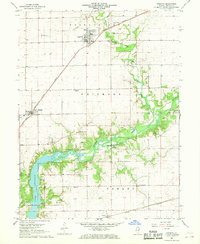
1967 · Argenta
USGS Topo · 1:24,000

1967 · Decatur
USGS Topo · 1:24,000