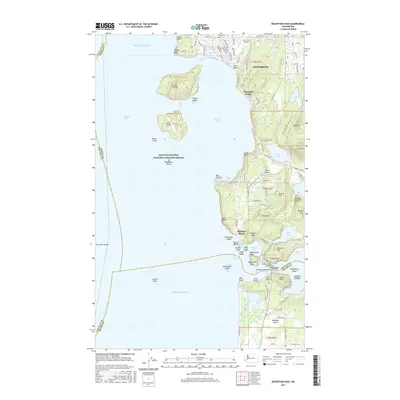
2017 Map of Deception Pass
USGS Topo · Published 2017About this map
Anacortes and the northern tip of Whidbey Island meet at the narrow, high-current gap of Deception Pass. This coastal landscape is defined by the intersection of Skagit, Island, and San Juan Counties, featuring a complex network of waterways including Rosario Strait, Burrows Bay, and Cornet Bay. The map documents the protected lands of the San Juan Islands National Wildlife Refuge, which encompasses offshore features like Williamson Rocks.
Find a feature on this map
125 named features on this map. Tap any name to fly to it.
Don’t see what you’re looking for? This feature index may not catch every label — zoom into the map to look around manually.
Map Details
Editions of this 2017 Deception Pass Map
This is the sole edition of this map. No revisions or reprints were ever made.
Other maps of this area

1943 · Richardson
USGS Topo · 1:62,500

1943 · Orcas Island
USGS Topo · 1:62,500

1943 · Deception Pass
USGS Topo · 1:62,500

1943 · Anacortes
USGS Topo · 1:62,500

1951 · Deception Pass
USGS Topo · 1:62,500

1951 · Anacortes
USGS Topo · 1:62,500

1957 · Richardson
USGS Topo · 1:62,500

1957 · Orcas Island
USGS Topo · 1:62,500

1957 · Victoria
USGS Topo · 1:250,000

1973 · Cypress Island
USGS Topo · 1:24,000