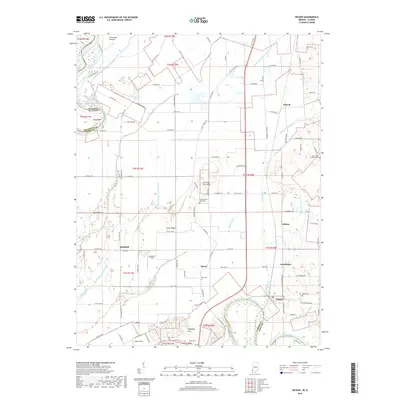
2019 Map of Decker
USGS Topo · Published 2019About this map
The Wabash River and White River frame this landscape at the intersection of Indiana and Illinois, where the rural topography is defined by an intricate network of drainage systems. Settlements such as Decker, Purcell, and Vollmer are connected by a grid of county roads, reflecting the agricultural character of the Vincennes Prairie region. This map provides critical detail for genealogists, documenting family-associated landmarks like Bedell Cem, Dick Cem, and the Saint Peter Lutheran Cem.
Find a feature on this map
78 named features on this map. Tap any name to fly to it.
Don’t see what you’re looking for? This feature index may not catch every label — zoom into the map to look around manually.
Map Details
Editions of this 2019 Decker Map
This is the sole edition of this map. No revisions or reprints were ever made.
Other maps of this area

1901 · Princeton
USGS Topo · 1:62,500

1902 · Ditney
USGS Topo · 1:125,000

1903 · Petersburg
USGS Topo · 1:62,500

1903 · Princeton
USGS Topo · 1:62,500

1903 · Patoka
USGS Topo · 1:125,000

1915 · Vincennes
USGS Topo · 1:62,500

1942 · Fritchton
USGS Topo · 1:24,000

1944 · Fritchton
USGS Topo · 1:24,000

1944 · Iona
USGS Topo · 1:24,000

1944 · Vincennes
USGS Topo · 1:62,500