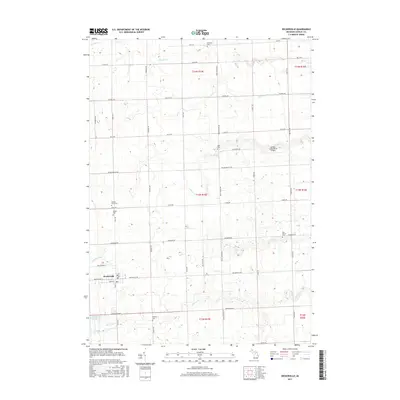
2017 Map of Deckerville
USGS Topo · Published 2017About this map
Deckerville serves as the primary hub of this agricultural landscape in Sanilac County, where the village grid is centered around the intersection of Black River St, Main St, and Deckerville Rd. The surrounding countryside is defined by a dense network of drainage and creek systems, including Big Gully Cr, Indian Cr, and the Pyette Drain, which supported the region's long-standing farming tradition. Genealogists will find significant value in the numerous smaller burial grounds scattered across the townships, such as the Russell Farm Cem and Wright Cem near the western boundary, or the East Marion Cem to the east. The presence of the Indian Creek Ranch Airport and the Deckerville Reservoir southwest of the village illustrate the 21st-century infrastructure and land management of this Thumb region community.
Find a feature on this map
50 named features on this map. Tap any name to fly to it.
Don’t see what you’re looking for? This feature index may not catch every label — zoom into the map to look around manually.
Map Details
Editions of this 2017 Deckerville Map
This is the sole edition of this map. No revisions or reprints were ever made.
Other maps of this area

1954 · Flint
USGS Topo · 1:250,000

1958 · Flint
USGS Topo · 1:250,000

1963 · Forestville
USGS Topo · 1:24,000

1963 · Ruth
USGS Topo · 1:24,000

1963 · Sandusky
USGS Topo · 1:24,000

1963 · Port Sanilac
USGS Topo · 1:24,000

1963 · Minden City
USGS Topo · 1:24,000

1963 · Palms
USGS Topo · 1:24,000

1963 · Deckerville
USGS Topo · 1:24,000

1963 · Richmondville
USGS Topo · 1:24,000
Featured Places
- Deckerville, MI
- Forester Township, MI
- Delaware Township, MI
- Bridgehampton Township, MI
- Marion Township, MI