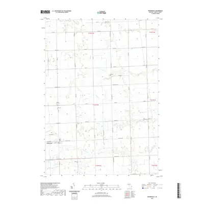
2019 Map of Deckerville
USGS Topo · Published 2019About this map
Deckerville serves as the primary hub of this eastern Sanilac County landscape, situated at the intersection of Deckerville Rd and Ruth Rd. The village is supported by the nearby Deckerville Reservoir, while the surrounding terrain is defined by a dense network of drainage systems such as Parson Drain, Grandy Drain, and Pyette Drain. These engineered waterways, alongside natural features like Elk Cr and Indian Cr, reflect the region's agricultural character and the necessity of managing water across the Thumb of Michigan.
Find a feature on this map
50 named features on this map. Tap any name to fly to it.
Don’t see what you’re looking for? This feature index may not catch every label — zoom into the map to look around manually.
Map Details
Editions of this 2019 Deckerville Map
This is the sole edition of this map. No revisions or reprints were ever made.
Other maps of this area

1954 · Flint
USGS Topo · 1:250,000

1958 · Flint
USGS Topo · 1:250,000

1963 · Forestville
USGS Topo · 1:24,000

1963 · Ruth
USGS Topo · 1:24,000

1963 · Sandusky
USGS Topo · 1:24,000

1963 · Port Sanilac
USGS Topo · 1:24,000

1963 · Minden City
USGS Topo · 1:24,000

1963 · Palms
USGS Topo · 1:24,000

1963 · Deckerville
USGS Topo · 1:24,000

1963 · Richmondville
USGS Topo · 1:24,000
Featured Places
- Deckerville, MI
- Forester Township, MI
- Delaware Township, MI
- Bridgehampton Township, MI
- Marion Township, MI