
1975 Map of Decorah 3 NW
USGS Topo · Published 1977About this map
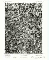
Fort Atkinson anchors the southern portion of this orthophotoquad, which reveals the geometric precision of mid-1970s Iowa agriculture alongside the winding riparian corridors of the Turkey River valley. This aerial perspective, captured in late September, highlights the distinct texture of harvested fields and woodlots that separate the concentrated settlements of Spillville and Conover. The imagery demonstrates the development of the regional road network as it connects these rural hubs, providing a clear record of land use and property divisions in Winneshiek County during this period. The spatial arrangement of farmsteads and the preservation of timber along the meandering watercourses offer an archival view of the landscape before modern expansion altered these traditional patterns of settlement.
Find a feature on this map
3 named features on this map. Tap any name to fly to it.
Don’t see what you’re looking for? This feature index may not catch every label — zoom into the map to look around manually.
Map Details
Editions of this 1975 Decorah 3 NW Map
This is the sole edition of this map. No revisions or reprints were ever made.
Other maps of this area

1906 · Decorah
USGS Topo · 1:125,000

1954 · Mason City
USGS Topo · 1:250,000

1957 · Mason City
USGS Topo · 1:250,000

1958 · Mason City
USGS Topo · 1:250,000

1958 · La Crosse
USGS Topo · 1:250,000

1961 · La Crosse
USGS Topo · 1:250,000

1965 · La Crosse
USGS Topo · 1:250,000

1975 · Decorah 2 SW
USGS Topo · 1:24,000
1975 · Decorah 3 NE
USGS Topo · 1:24,000
1975 · Decorah 2 SE
USGS Topo · 1:24,000