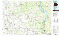
1985 Map of Decorah
USGS Topo · Published 1985About this map
Effigy Mounds National Monument and the prehistoric earthworks at Fish Farm Indian Mounds State Recreation Area anchor the eastern edge of this landscape along the Mississippi River. The mid-1980s terrain is defined by the deeply carved valleys of the Upper Iowa River and the Yellow River, where numerous quarries dot the bluffs overlooking settlements like Decorah and Waukon. The region's archaeological and geological significance is further highlighted by features such as Wonder Cave and Glenwood Cave.
Find a feature on this map
160 named features on this map. Tap any name to fly to it.
Don’t see what you’re looking for? This feature index may not catch every label — zoom into the map to look around manually.
Map Details
Editions of this 1985 Decorah Map
2 editions found
Other maps of this area

1900 · Lancaster
USGS Topo · 1:125,000

1901 · Oelwein
USGS Topo · 1:125,000

1902 · Elkader
USGS Topo · 1:125,000

1903 · Waukon
USGS Topo · 1:125,000

1904 · Lancaster
USGS Topo · 1:125,000

1906 · Decorah
USGS Topo · 1:125,000

1908 · Lancaster
USGS Topo · 1:125,000

1923 · Viroqua
USGS Topo · 1:62,500

1924 · Gays Mills
USGS Topo · 1:62,500

1926 · Gays Mills
USGS Topo · 1:62,500