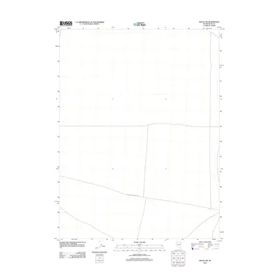
2012 Map of Decoy SW
USGS Topo · Published 2012About this map
Dolly Varden Spring Rd crosses this high desert landscape within Elko County, Nevada, providing one of the few named navigation points in an otherwise open and sparse terrain. The U.S. Geological Survey recorded this area in 2012, showing a grid of section lines that mark the land divisions of the Great Basin. This specific survey highlights the minimal infrastructure typical of this part of northeastern Nevada, where topography is defined by subtle elevation changes rather than dense settlement or industrial development. For those studying the transit routes of the region, the placement of the single arterial road across the southern portion of the quadrangle offers a clear view of the modern trail system used to access these remote reaches.
Find a feature on this map
1 named feature on this map. Tap any name to fly to it.
Don’t see what you’re looking for? This feature index may not catch every label — zoom into the map to look around manually.
Map Details
Editions of this 2012 Decoy SW Map
This is the sole edition of this map. No revisions or reprints were ever made.
Other maps of this area

1953 · Spruce Mountain 4
USGS Topo · 1:62,500

1955 · Elko
USGS Topo · 1:250,000

1958 · Elko
USGS Topo · 1:250,000

1962 · Elko
USGS Topo · 1:250,000

1965 · Elko
USGS Topo · 1:250,000

1971 · Decoy
USGS Topo · 1:24,000

1972 · Morgan Pass
USGS Topo · 1:24,000

1972 · Lion Spring
USGS Topo · 1:24,000

1972 · Decoy SW
USGS Topo · 1:24,000
1982 · Goshute Peak
USGS Topo · 1:24,000