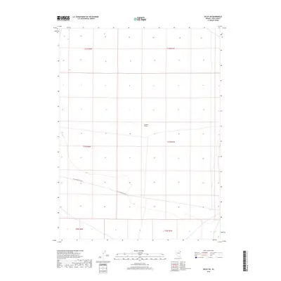
2018 Map of Decoy SW
USGS Topo · Published 2018About this map
Goshute Valley defines the geography of this Elko County interior, a wide alluvial expanse that characterizes the High Desert of northeastern Nevada. This 2018 survey documents a remote landscape primarily utilized for open range and transit, with the passage of Dolly Varden Spring Rd providing the primary corridor through the southern reaches of the valley. The map details the intricate Public Land Survey System (PLSS) grid, showing the boundaries of several townships including t31n r67e, which overlay the valley floor. The sparse distribution of man-made infrastructure highlights the endurance of large-scale grazing and traditional land use patterns in this part of the Great Basin, where topographic contour lines reveal the subtle drainage patterns leading into the heart of the valley.
Find a feature on this map
8 named features on this map. Tap any name to fly to it.
Don’t see what you’re looking for? This feature index may not catch every label — zoom into the map to look around manually.
Map Details
Editions of this 2018 Decoy SW Map
This is the sole edition of this map. No revisions or reprints were ever made.
Other maps of this area

1953 · Spruce Mountain 4
USGS Topo · 1:62,500

1955 · Elko
USGS Topo · 1:250,000

1958 · Elko
USGS Topo · 1:250,000

1962 · Elko
USGS Topo · 1:250,000

1965 · Elko
USGS Topo · 1:250,000

1971 · Decoy
USGS Topo · 1:24,000

1972 · Morgan Pass
USGS Topo · 1:24,000

1972 · Lion Spring
USGS Topo · 1:24,000

1972 · Decoy SW
USGS Topo · 1:24,000
1982 · Goshute Peak
USGS Topo · 1:24,000