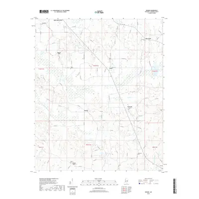
2018 Map of Deemer
USGS Topo · Published 2018About this map
Philadelphia, Mississippi, anchors the northern edge of this landscape where rural settlements like Deemer and Spring Hill sit among the timber and headwaters of Neshoba County. The terrain is defined by engineered water management, including the Cushtusia Canal and Coonshuck Canal, which reflect efforts to drain the low-lying bottoms for agricultural use. Small community centers such as Beatline and Tucker are connected by a network of county roads and Bureau of Indian Affairs routes, signaling the local presence of the Mississippi Band of Choctaw Indians. Family and community heritage is preserved across several burial grounds, including Spring Hill Cem, Bloomfield Cem, and Center Hill Cem. These landmarks, along with high points like Rock Gut Hill and Circle Hill, provide a detailed view of the rural Neshoba County social geography.
Find a feature on this map
89 named features on this map. Tap any name to fly to it.
Don’t see what you’re looking for? This feature index may not catch every label — zoom into the map to look around manually.
Map Details
Editions of this 2018 Deemer Map
This is the sole edition of this map. No revisions or reprints were ever made.
Other maps of this area

1953 · Meridian
USGS Topo · 1:250,000

1957 · Meridian
USGS Topo · 1:250,000

1962 · House
USGS Topo · 1:24,000

1962 · Owl Creek
USGS Topo · 1:24,000

1962 · Post
USGS Topo · 1:24,000

1965 · Meridian
USGS Topo · 1:250,000

1972 · Pearl River
USGS Topo · 1:24,000

1972 · Deemer
USGS Topo · 1:24,000

1972 · Union East
USGS Topo · 1:24,000
1972 · Philadelphia
USGS Topo · 1:24,000