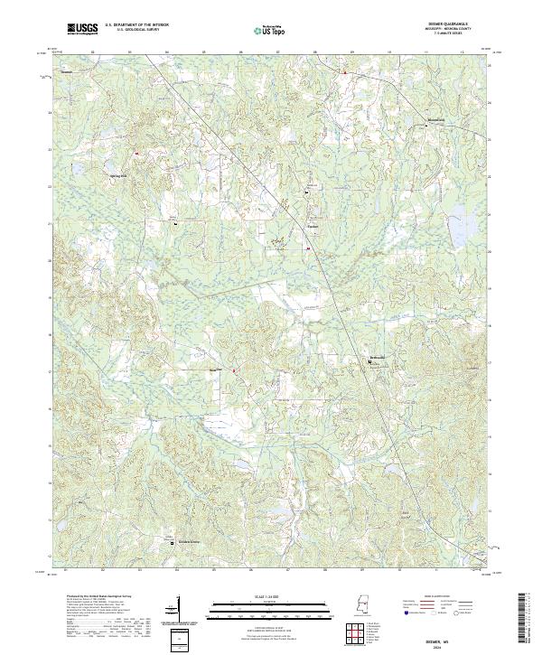
2024 Map of Deemer
USGS Topo · Published 2024About this map
Bethsaida Baptist Church and several small community cemeteries anchor this rural landscape in eastern Neshoba County. The terrain is defined by a series of engineered watercourses, most notably the Cushtusia Canal and Coonshuck Canal, which cut through the lowlands to manage drainage. These canals parallel natural tributaries like Blinker Creek and Winstead Branch, reflecting a landscape heavily modified for agriculture and flood control.
Find a feature on this map
90 named features on this map. Tap any name to fly to it.
Don’t see what you’re looking for? This feature index may not catch every label — zoom into the map to look around manually.
Map Details
Editions of this 2024 Deemer Map
This is the sole edition of this map. No revisions or reprints were ever made.
Other maps of this area

1953 · Meridian
USGS Topo · 1:250,000

1957 · Meridian
USGS Topo · 1:250,000

1962 · House
USGS Topo · 1:24,000

1962 · Owl Creek
USGS Topo · 1:24,000

1962 · Post
USGS Topo · 1:24,000

1965 · Meridian
USGS Topo · 1:250,000

1972 · Pearl River
USGS Topo · 1:24,000

1972 · Deemer
USGS Topo · 1:24,000

1972 · Union East
USGS Topo · 1:24,000
1972 · Philadelphia
USGS Topo · 1:24,000