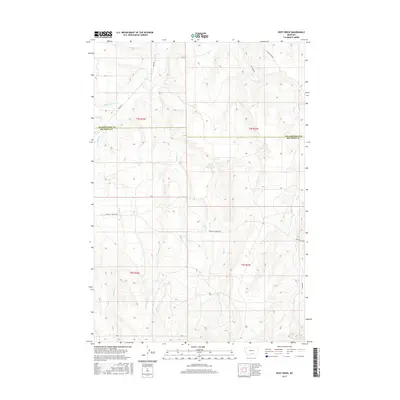
2017 Map of Deep Creek
USGS Topo · Published 2017About this map
The boundary between Yellowstone and Big Horn counties runs through this Montana landscape, where a dense network of drainages flows toward the larger valleys. Pryor Cr winds across the northern sections, joined by tributaries with evocative names like Fourth of July Cr, Plum Cr, and Smallpox Cr. The terrain is defined by a system of ridges and coulees, through which the namesake Deep Cr and Porcupine Cr carve their paths. Transportation across these rural lands is facilitated by the Pryor St Xavier Hwy and Pryor Rd, which track the natural contours of the foothills. This 2017 survey captures the area's intricate hydrography, including Middle Cr, Cottonwood Cr, and Hay Cr, illustrating the rugged drainage patterns typical of the region south of the Yellowstone River.
Find a feature on this map
20 named features on this map. Tap any name to fly to it.
Don’t see what you’re looking for? This feature index may not catch every label — zoom into the map to look around manually.
Map Details
Editions of this 2017 Deep Creek Map
This is the sole edition of this map. No revisions or reprints were ever made.
Other maps of this area

1893 · Huntley
USGS Topo · 1:125,000

1954 · Billings
USGS Topo · 1:250,000

1957 · Billings
USGS Topo · 1:250,000

1958 · Billings
USGS Topo · 1:250,000

1967 · Deep Creek SE
USGS Topo · 1:24,000

1967 · Castle Rocks
USGS Topo · 1:24,000

1967 · Deep Creek
USGS Topo · 1:24,000

1967 · Pryor
USGS Topo · 1:24,000

1967 · Deep Creek SW
USGS Topo · 1:24,000

1967 · Soda Springs
USGS Topo · 1:24,000