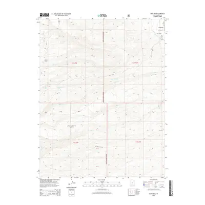
2014 Map of Deep Creek
USGS Topo · Published 2014About this map
Antimony stands as the primary settlement on this 2014 survey, positioned where the E Fork Sevier River exits the mountainous terrain. This high-altitude landscape is dominated by the Sevier Plateau and the peaks of Mount Dutton and S Mount Dutton. Much of the territory falls within the Dixie National Forest, showing a network of drainages such as Deep Cr, Pine Cr, and Hoodle Cr that carve through the volcanic geology. The map provides clear detail of the transition from the river valley's agricultural roads, including S River Rd and N Main St, into the steep canyons and plateaus. Researchers can trace the rugged transition from the valley floor up to landmarks like Table Mtn and the depths of Deer Creek-Black Canyon, revealing the geographic isolation and drainage patterns of this portion of Garfield County.
Find a feature on this map
32 named features on this map. Tap any name to fly to it.
Don’t see what you’re looking for? This feature index may not catch every label — zoom into the map to look around manually.
Map Details
Editions of this 2014 Deep Creek Map
This is the sole edition of this map. No revisions or reprints were ever made.
Other maps of this area

1885 · Beaver
USGS Topo · 1:250,000

1885 · Fish Lake
USGS Topo · 1:250,000

1886 · Kanab
USGS Topo · 1:250,000

1886 · Escalante
USGS Topo · 1:250,000

1896 · Fish Lake
USGS Topo · 1:250,000

1953 · Richfield
USGS Topo · 1:250,000

1953 · Cedar City
USGS Topo · 1:250,000

1956 · Escalante
USGS Topo · 1:250,000

1956 · Salina
USGS Topo · 1:250,000

1958 · Richfield
USGS Topo · 1:250,000