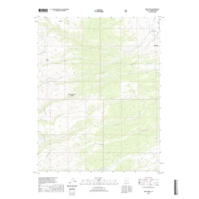
2020 Map of Deep Creek
USGS Topo · Published 2020About this map
Antimony anchors the northeastern corner of this Garfield County survey, where Main St and Jones Corral meet the E Fork Sevier River. The landscape is dominated by the dramatic elevation changes of the Sevier Plateau and the deeply incised drainage of Deer Creek Black Canyon. A significant portion of the area is protected within the Dixie National Forest, featuring prominent landforms like Table Mtn and the winding Mount Dutton Trail. The intricate water network, including Hoodle Cr, Willow Spring Cr, and Pine Cr, illustrates the complex hydrologic pattern that has shaped this high-elevation region. Notable landmarks such as Willow Spring and Dry Hollow provide specific points of reference for those studying the physical history and land use of this part of southern Utah.
Find a feature on this map
22 named features on this map. Tap any name to fly to it.
Don’t see what you’re looking for? This feature index may not catch every label — zoom into the map to look around manually.
Map Details
Editions of this 2020 Deep Creek Map
This is the sole edition of this map. No revisions or reprints were ever made.
Other maps of this area

1885 · Beaver
USGS Topo · 1:250,000

1885 · Fish Lake
USGS Topo · 1:250,000

1886 · Kanab
USGS Topo · 1:250,000

1886 · Escalante
USGS Topo · 1:250,000

1896 · Fish Lake
USGS Topo · 1:250,000

1953 · Richfield
USGS Topo · 1:250,000

1953 · Cedar City
USGS Topo · 1:250,000

1956 · Escalante
USGS Topo · 1:250,000

1956 · Salina
USGS Topo · 1:250,000

1958 · Richfield
USGS Topo · 1:250,000