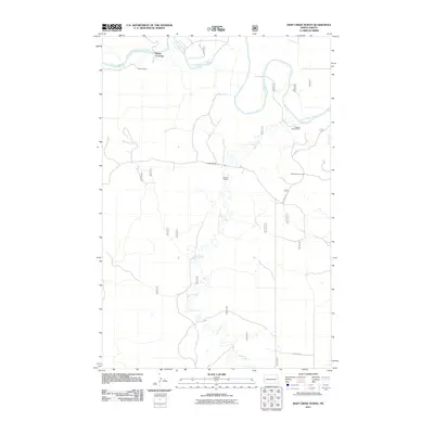
2011 Map of Deep Creek North
USGS Topo · Published 2011About this map
The Little Missouri River meanders through this portion of Slope County, defining a landscape marked by isolated ranching outposts and rugged coulees. Near Walser Crossing in the northwest, the Walser Ranch sits near the riverbanks, while the Logging Camp Ranch and Jacobson Ranch occupy the eastern and central reaches. The terrain is characterized by drainage systems like Spring Coulee and Deep Creek that feed into the primary river valley. A notable botanical landmark, the Ponderosa Pine Area, stands near the eastern edge along E River Rd. This survey reflects the enduring cattle ranching tradition of the North Dakota Badlands, where topography and water access dictate the placement of every homestead, such as the K Hafele Ranch.
Find a feature on this map
11 named features on this map. Tap any name to fly to it.
Don’t see what you’re looking for? This feature index may not catch every label — zoom into the map to look around manually.
Map Details
Editions of this 2011 Deep Creek North Map
This is the sole edition of this map. No revisions or reprints were ever made.
Other maps of this area

1953 · Dickinson
USGS Topo · 1:250,000

1957 · Dickinson
USGS Topo · 1:250,000

1961 · Rocky Ridge
USGS Topo · 1:62,500

1973 · Black Butte
USGS Topo · 1:24,000

1979 · Deep Creek North
USGS Topo · 1:24,000

1979 · Bullion Butte
USGS Topo · 1:24,000

1980 · Spring Creek
USGS Topo · 1:24,000

1980 · Belfield
USGS Topo · 1:100,000

1981 · Bowman
USGS Topo · 1:100,000
1982 · Cliffs Plateau
USGS Topo · 1:24,000