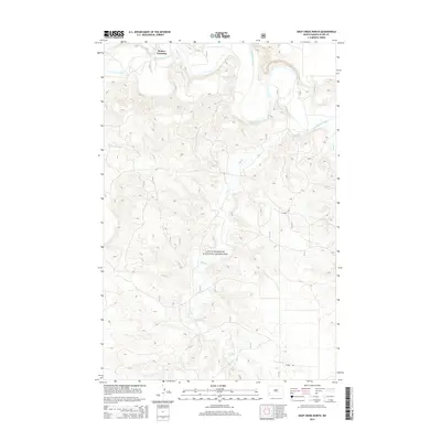
2014 Map of Deep Creek North
USGS Topo · Published 2014About this map
Walser Crossing serves as a primary reference point in this corner of Slope County, where the Little Missouri River meanders through the Badlands. The landscape is dominated by the sprawling protected acreage of the Little Missouri National Grassland, characterized by intricate drainage patterns and plateaus. Seasonal waterways and drainages such as Spring Coulee, Sand Cr, and the namesake Deep Creek carve through the terrain, illustrating the erosive forces that shape this semi-arid environment. Human activity is sparsely represented, primarily by E River Rd and minor access tracks, reflecting the area's ongoing use for grazing and conservation rather than dense settlement. This 2014 survey captures the topography of the grasslands prior to any further modern industrial or infrastructural developments in the region.
Find a feature on this map
7 named features on this map. Tap any name to fly to it.
Don’t see what you’re looking for? This feature index may not catch every label — zoom into the map to look around manually.
Map Details
Editions of this 2014 Deep Creek North Map
This is the sole edition of this map. No revisions or reprints were ever made.
Other maps of this area

1953 · Dickinson
USGS Topo · 1:250,000

1957 · Dickinson
USGS Topo · 1:250,000

1961 · Rocky Ridge
USGS Topo · 1:62,500

1973 · Black Butte
USGS Topo · 1:24,000

1979 · Deep Creek North
USGS Topo · 1:24,000

1979 · Bullion Butte
USGS Topo · 1:24,000

1980 · Spring Creek
USGS Topo · 1:24,000

1980 · Belfield
USGS Topo · 1:100,000

1981 · Bowman
USGS Topo · 1:100,000
1982 · Cliffs Plateau
USGS Topo · 1:24,000