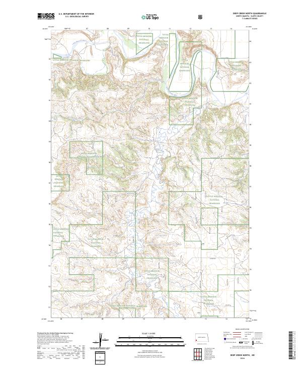
2024 Map of Deep Creek North
USGS Topo · Published 2024About this map
The Little Missouri National Grassland dominates this landscape in Slope County, where the Little Missouri River carves a winding path through the northern reaches of the quadrangle. This 2024 survey documents a territory defined by its complex drainage systems and the vast public lands managed by the U.S. Forest Service. Seasonal watercourses including Spring Coulee and Deep Creek cut across the high plains, illustrating the erosion patterns characteristic of the western North Dakota badlands. Human imprint is sparse, restricted primarily to a grid of section lines and gravel connectors like E River Rd and 152nd Ave SW. The map provides a clear view of the cadastral layout within townships t136n r103w and t135n r103w, showing the relationship between protected federal land and private holdings.
Find a feature on this map
13 named features on this map. Tap any name to fly to it.
Don’t see what you’re looking for? This feature index may not catch every label — zoom into the map to look around manually.
Map Details
Editions of this 2024 Deep Creek North Map
This is the sole edition of this map. No revisions or reprints were ever made.
Other maps of this area

1953 · Dickinson
USGS Topo · 1:250,000

1957 · Dickinson
USGS Topo · 1:250,000

1961 · Rocky Ridge
USGS Topo · 1:62,500

1973 · Black Butte
USGS Topo · 1:24,000

1979 · Deep Creek North
USGS Topo · 1:24,000

1979 · Bullion Butte
USGS Topo · 1:24,000

1980 · Spring Creek
USGS Topo · 1:24,000

1980 · Belfield
USGS Topo · 1:100,000

1981 · Bowman
USGS Topo · 1:100,000
1982 · Cliffs Plateau
USGS Topo · 1:24,000