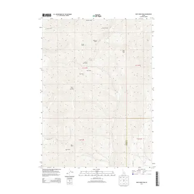
2013 Map of Deep Creek Peak
USGS Topo · Published 2013About this map
The Deep Creek Mountains dominate this high-altitude landscape along the border of Power and Oneida counties. Reaching a prominent summit at Deep Creek Peak, the terrain is defined by a dense network of drainages and named hollows, reflecting a history of local geographic naming. Deep incisions like Sawmill Canyon and Wheeler Canyon suggest a landscape long utilized for its natural resources, while names such as Reservoir Canyon point to water management efforts in this arid high-country environment.
Find a feature on this map
20 named features on this map. Tap any name to fly to it.
Don’t see what you’re looking for? This feature index may not catch every label — zoom into the map to look around manually.
Map Details
Editions of this 2013 Deep Creek Peak Map
This is the sole edition of this map. No revisions or reprints were ever made.
Other maps of this area

1934 · Rockland
USGS Topo · 1:62,500

1937 · Rockland
USGS Topo · 1:62,500

1938 · Pauline
USGS Topo · 1:48,000

1944 · Arbon
USGS Topo · 1:62,500

1954 · Pocatello
USGS Topo · 1:250,000

1958 · Pocatello
USGS Topo · 1:250,000

1971 · Rockland East
USGS Topo · 1:24,000

1971 · Bannock Peak
USGS Topo · 1:24,000
1971 · Pauline
USGS Topo · 1:24,000
1973 · Arbon
USGS Topo · 1:24,000