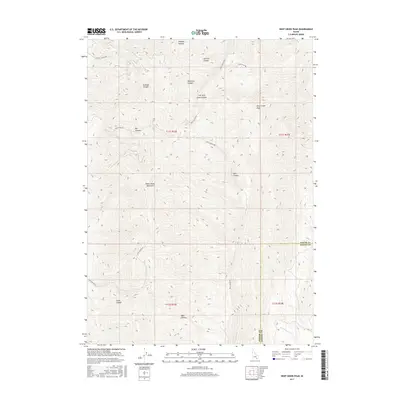
2017 Map of Deep Creek Peak
USGS Topo · Published 2017About this map
Deep Creek Peak dominates the high-elevation landscape of the Deep Creek Mountains along the boundary between Power and Oneida counties. This terrain is characterized by a series of significant drainages and canyons, including Wheeler Canyon, Sawmill Canyon, and Reservoir Canyon, which channel water toward the lower elevations. The map reveals a network of primitive and improved routes used for mountain access, such as Portage Canyon Rd and Bull Canyon Rd. In the southern portion of the quadrangle, the topography softens slightly near Bear Hollow and the headwaters of Bannock Cr. The naming of features like Left Fork Knox Canyon and Yates Canyon reflects a history of local land use and geographic identification in this high Idaho backcountry during the early twenty-first century.
Find a feature on this map
23 named features on this map. Tap any name to fly to it.
Don’t see what you’re looking for? This feature index may not catch every label — zoom into the map to look around manually.
Map Details
Editions of this 2017 Deep Creek Peak Map
This is the sole edition of this map. No revisions or reprints were ever made.
Other maps of this area

1934 · Rockland
USGS Topo · 1:62,500

1937 · Rockland
USGS Topo · 1:62,500

1938 · Pauline
USGS Topo · 1:48,000

1944 · Arbon
USGS Topo · 1:62,500

1954 · Pocatello
USGS Topo · 1:250,000

1958 · Pocatello
USGS Topo · 1:250,000

1971 · Rockland East
USGS Topo · 1:24,000

1971 · Bannock Peak
USGS Topo · 1:24,000
1971 · Pauline
USGS Topo · 1:24,000
1973 · Arbon
USGS Topo · 1:24,000