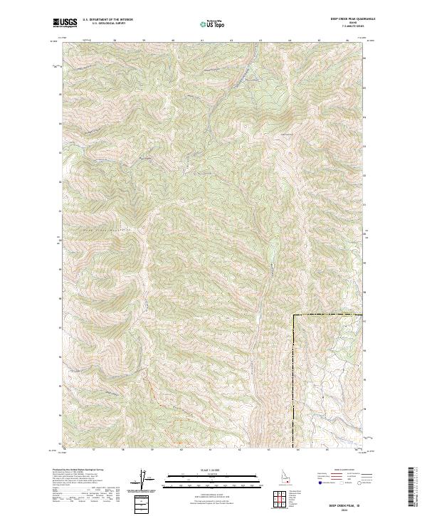
2024 Map of Deep Creek Peak
USGS Topo · Published 2024About this map
Deep Creek Peak serves as the focal point for this 2024 survey of the southern Deep Creek Mountains, where the boundary between Power and Oneida counties crosses a series of high ridges and deep drainages. The landscape is defined by a complex system of named canyons that radiate from the central high ground, including Big Canyon, Bull Canyon, and the appropriately named Sawmill Canyon. To the south, Bear Hollow and Yates Canyon provide a detailed look at the drainage patterns feeding toward Bannock Creek at the map's edge. This modern topographic record captures the rugged character of the Basin and Range province, showing the network of local access routes like Sand Gulch Rd and Bull Canyon Rd that navigate the steep terrain between Portage Canyon and Knox Canyon.
Find a feature on this map
20 named features on this map. Tap any name to fly to it.
Don’t see what you’re looking for? This feature index may not catch every label — zoom into the map to look around manually.
Map Details
Editions of this 2024 Deep Creek Peak Map
This is the sole edition of this map. No revisions or reprints were ever made.
Other maps of this area

1934 · Rockland
USGS Topo · 1:62,500

1937 · Rockland
USGS Topo · 1:62,500

1938 · Pauline
USGS Topo · 1:48,000

1944 · Arbon
USGS Topo · 1:62,500

1954 · Pocatello
USGS Topo · 1:250,000

1958 · Pocatello
USGS Topo · 1:250,000

1971 · Rockland East
USGS Topo · 1:24,000

1971 · Bannock Peak
USGS Topo · 1:24,000
1971 · Pauline
USGS Topo · 1:24,000
1973 · Arbon
USGS Topo · 1:24,000