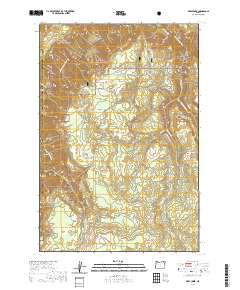
2020 Map of Deep Creek
USGS Topo · Published 2020About this map
The Grande Ronde River carves a deep, winding corridor through this remote intersection of northeastern Oregon, where the Umatilla National Forest meets the Wallowa National Forest. This protected wilderness area is characterized by high meadows and a complex drainage system, including the federally designated Grande Ronde Wild and Scenic River segment. Several high-elevation clearings such as Newman Meadows, Brown Meadows, and Grove Meadow punctuate the timbered slopes, serving as critical landmarks in an otherwise roadless expanse. Key water sources like Ferguson Spring and tributaries such as Deep Cr, Grossman Cr, and Clear Cr define the hydrological pattern of this high country. The map also delineates the jurisdictional boundary between Union Co and Wallowa Co, following the rugged terrain of the Blue Mountains region.
Find a feature on this map
23 named features on this map. Tap any name to fly to it.
Don’t see what you’re looking for? This feature index may not catch every label — zoom into the map to look around manually.
Map Details
Editions of this 2020 Deep Creek Map
This is the sole edition of this map. No revisions or reprints were ever made.
Other maps of this area

1955 · Grangeville
USGS Topo · 1:250,000

1959 · Grangeville
USGS Topo · 1:250,000

1964 · Howard Butte
USGS Topo · 1:24,000

1964 · Akers Butte
USGS Topo · 1:24,000

1964 · Rondowa
USGS Topo · 1:24,000

1967 · Fry Meadow
USGS Topo · 1:24,000

1967 · Eden
USGS Topo · 1:24,000

1967 · Elbow Creek
USGS Topo · 1:24,000

1967 · Promise
USGS Topo · 1:24,000
1967 · Deep Creek
USGS Topo · 1:24,000