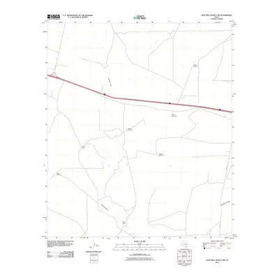
2010 Map of Deep Well Ranch NW
USGS Topo · Published 2010About this map
Graef Ranch and Hayter Ranch stand as primary landmarks in this high-desert stretch of Pecos County at the start of the twenty-first century. The landscape is defined by the ephemeral drainage patterns of Lawrence Draw and Schoolhouse Draw, which carve through the arid terrain. This 2010 survey highlights a specialized ranching infrastructure, where water access is managed through a network of named points including Balcom Windmill, Barrilla Windmill, and Eclipse Windmill. These features indicate the ongoing importance of groundwater in supporting local land use across the expansive cattle country. Transportation in the area is facilitated by established routes such as Hoefs Rd and Hovey Rd, which provide connectivity between isolated ranch steadings and the broader region.
Find a feature on this map
11 named features on this map. Tap any name to fly to it.
Don’t see what you’re looking for? This feature index may not catch every label — zoom into the map to look around manually.
Map Details
Editions of this 2010 Deep Well Ranch NW Map
This is the sole edition of this map. No revisions or reprints were ever made.
Other maps of this area

1894 · Fort Davis
USGS Topo · 1:125,000

1897 · Fort Davis
USGS Topo · 1:125,000

1921 · Toyah
USGS Topo · 1:125,000

1929 · Hovey
USGS Topo · 1:125,000

1931 · Barstow
USGS Topo · 1:125,000

1954 · Pecos
USGS Topo · 1:250,000

1954 · Fort Stockton
USGS Topo · 1:250,000

1955 · Saragosa
USGS Topo · 1:62,500

1957 · Pecos
USGS Topo · 1:250,000

1958 · Fort Stockton
USGS Topo · 1:250,000